


AgEngineering 🌾 | Computer Vision 👁️ | Spatial Data & GIS 🌍
I build deep-learning frameworks, digital twins, and self-supervised architectures for agronomic and environmental applications, combining GIS, remote sensing, and machine learning with rigorously validated, reproducible research code.
Grouped by research domain, ordered by overall importance within each group.
A foundational architecture, not tied to one crop or one physical process, meant to generalize across many downstream agronomic imaging tasks.
|
Geometry-Agnostic Contrastive Learning (GACL) A hypergraph-transformer architecture for cross-pathology, cross-condition contrastive transfer learning in agronomic imaging. 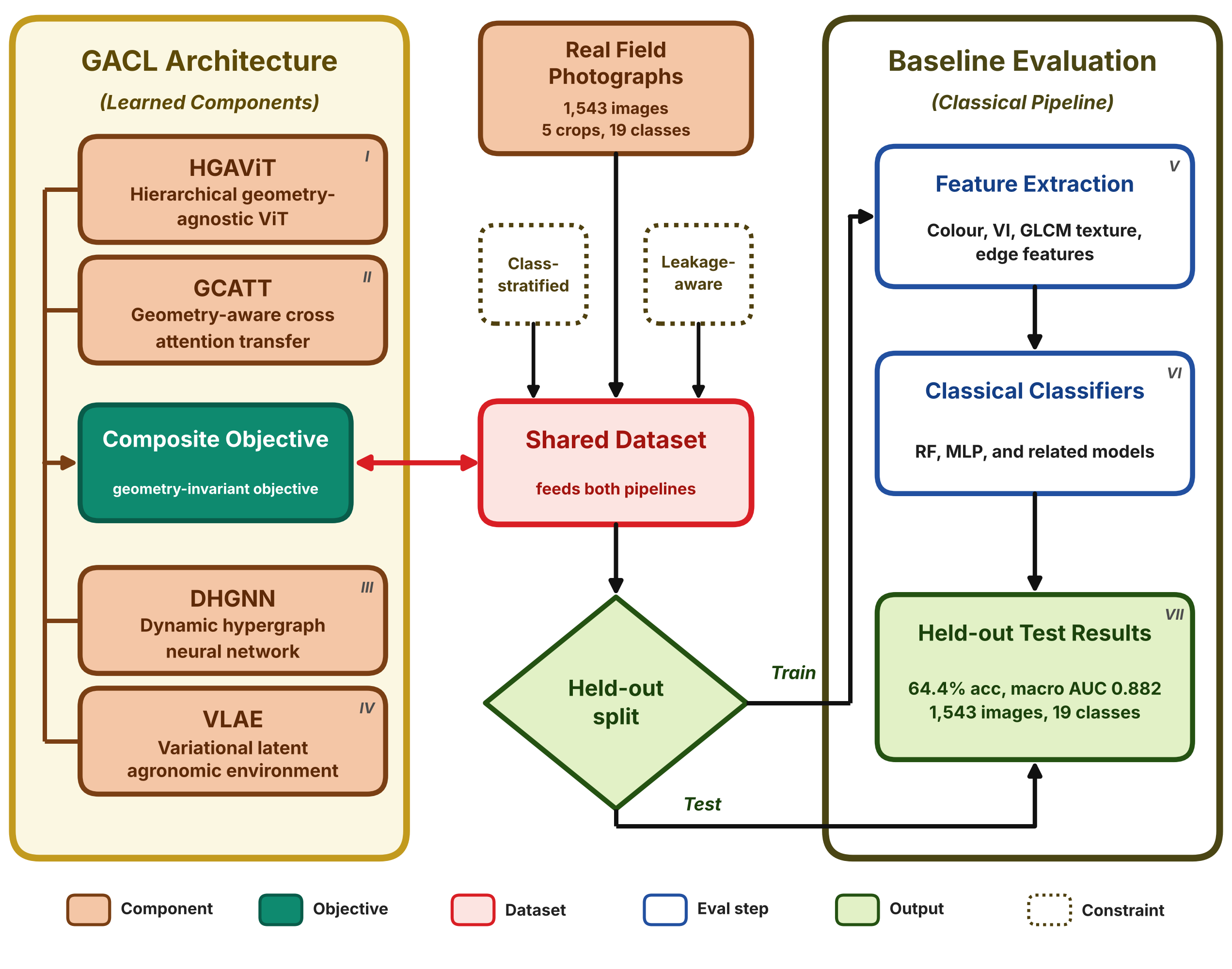
🔀 Methodology / Workflow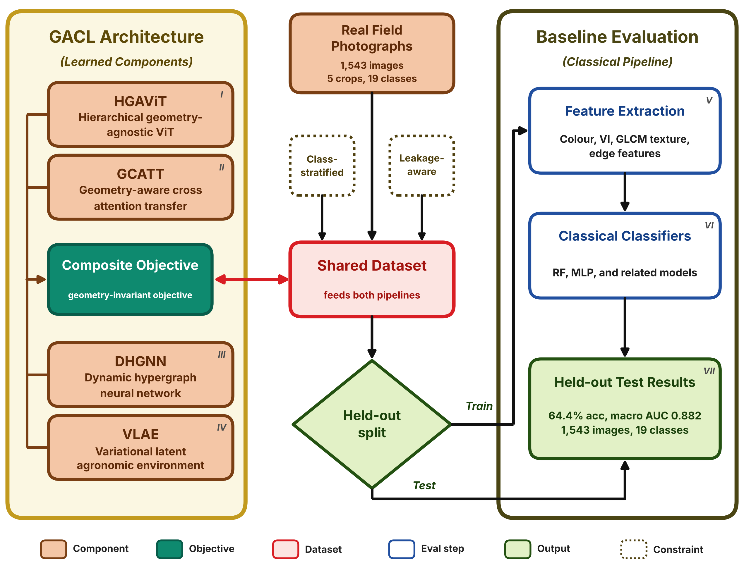
|
Modelling how water moves and erodes land, the physical processes of gully formation and sediment transport.
|
Digital Twin for Gully Biocontrol Bayesian-grounded digital twin evaluating Morning Glory (Ipomoea spp.) as a gully-erosion biocontrol measure, validated against real field-sensor data. 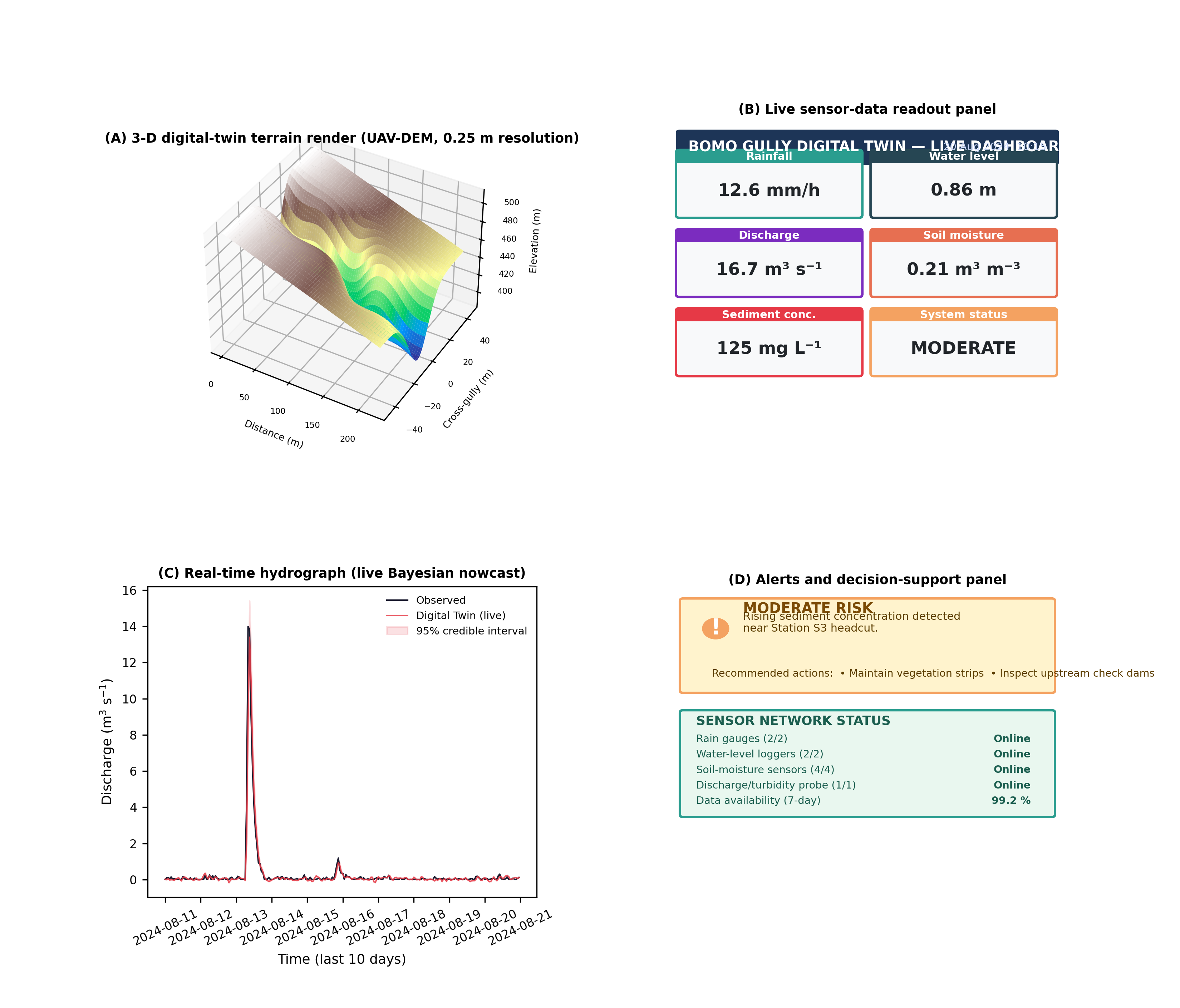
🔀 Methodology / Workflow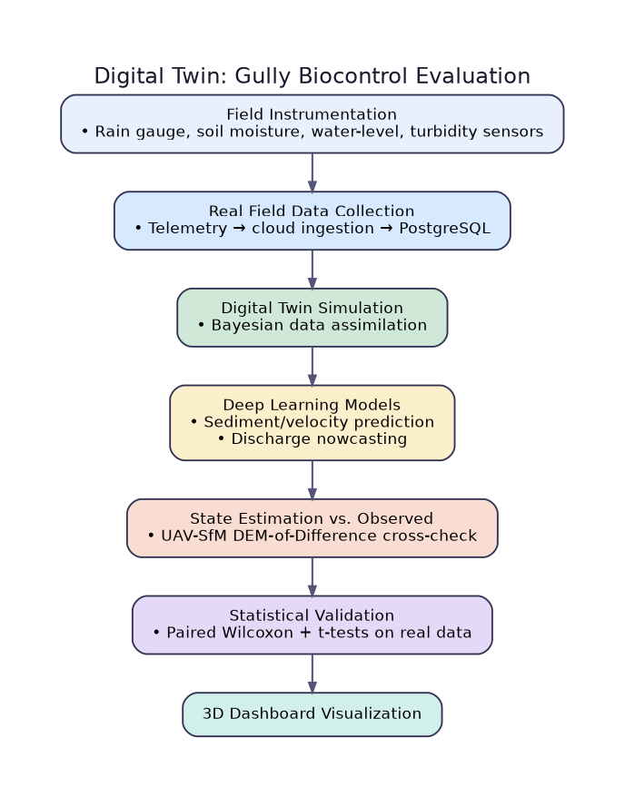
|
Hybrid CNN-BiLSTM-Attention for Sediment Transport A from-scratch NumPy deep-learning framework for sediment-transport prediction in an agricultural gully system. 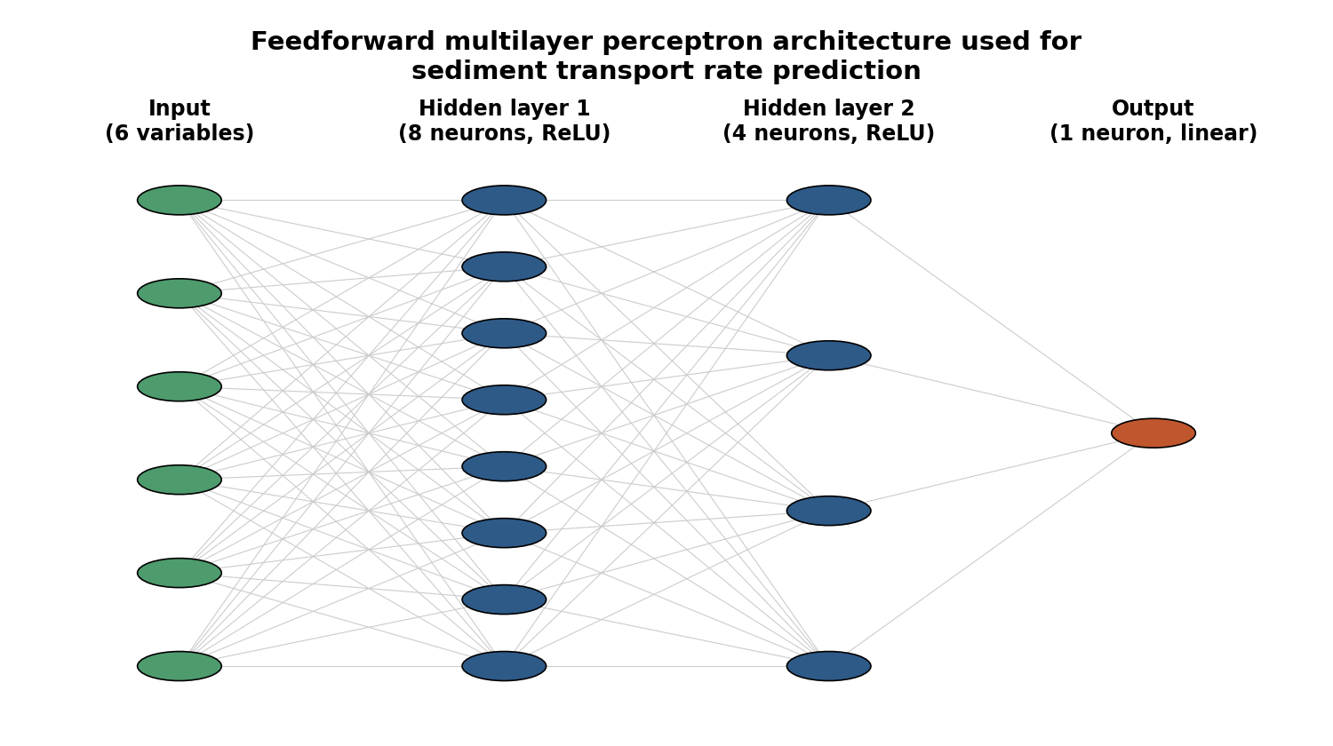
🔀 Methodology / Workflow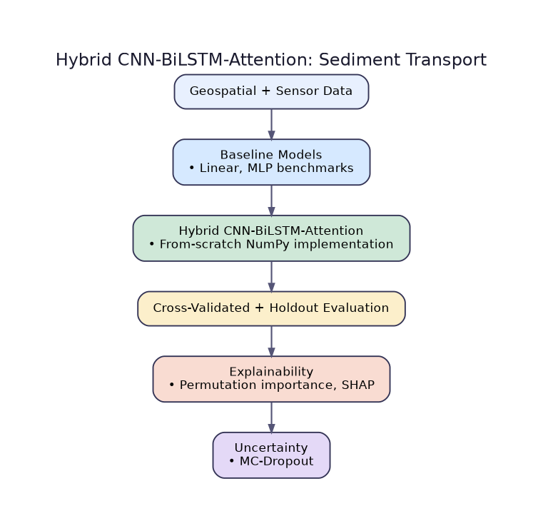
|
Correcting, extracting, and teaching how to work with satellite and drone imagery, the data layer beneath everything else.
|
STADOS: Spectral-Temporal Adaptive Dark Object Subtraction A five-stage radiometric harmonization framework that generalizes classical dark-object subtraction into a multi-object, reliability-weighted, iteratively self-consistent correction for multi-temporal Sentinel-2 NDVI monitoring, applied to corn parcels near Coimbra, Portugal. 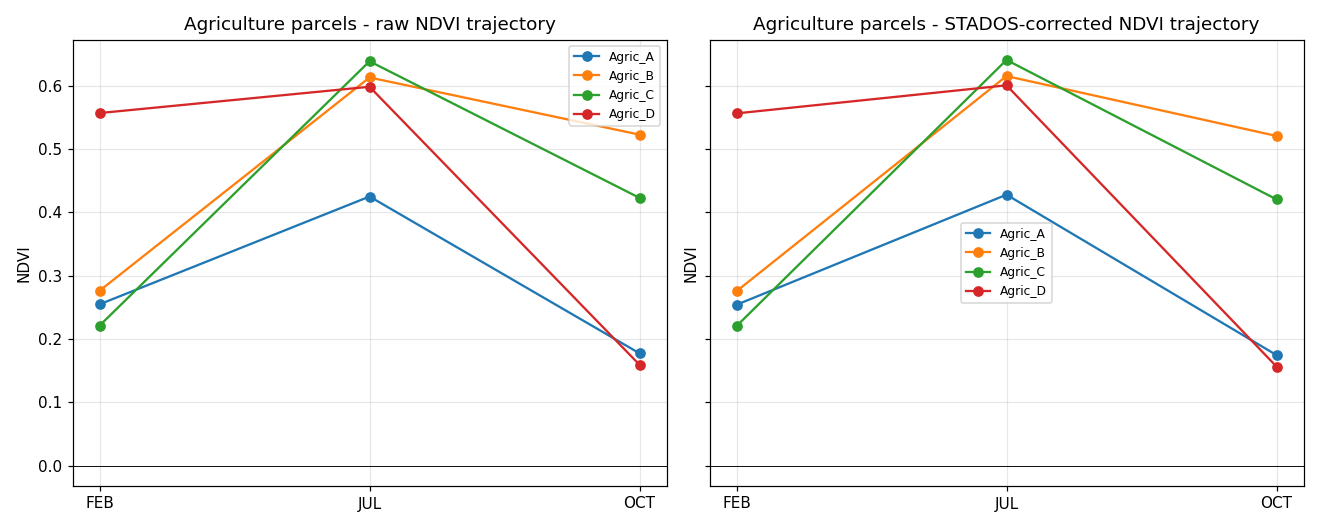
🔀 Methodology / Workflow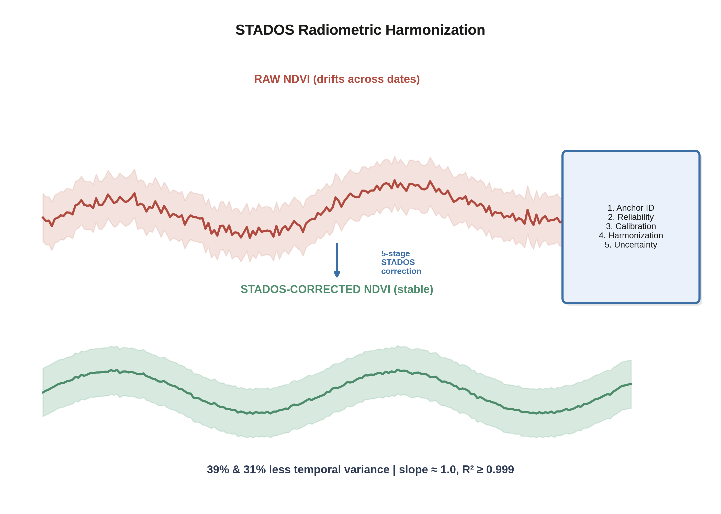
|
Real-Time RGB Vegetation Indexing (UAV/Handheld) Real-time RGB proxy vegetation indexing and texture analysis pipeline for UAV and handheld crop imagery, with an integrated GIS workbench. 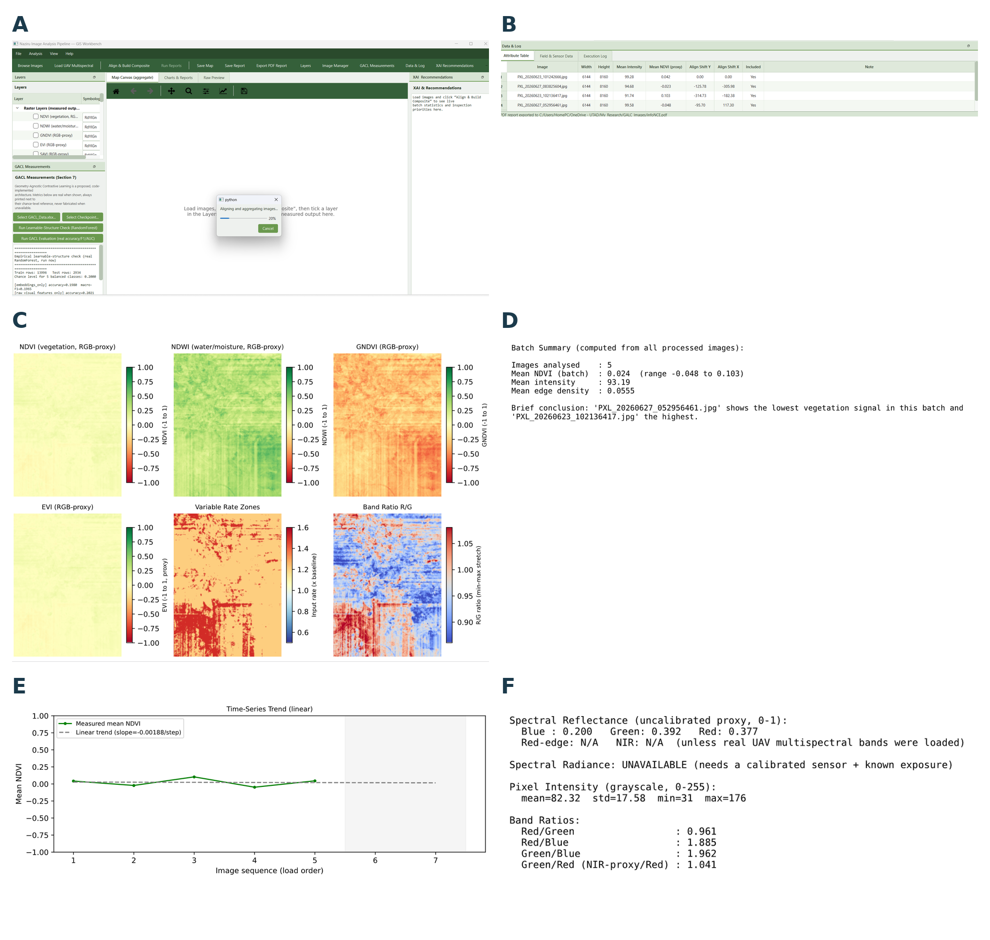
🔀 Methodology / Workflow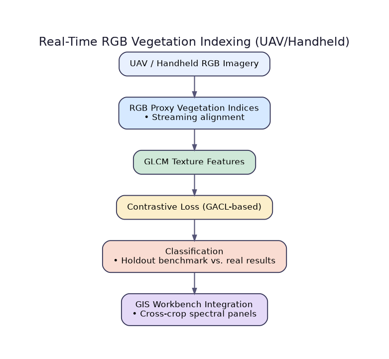
|
|
Geospatial Data Analysis, vector/raster GIS, Sentinel-1/2 remote sensing, and classification course package (Jupyter notebooks + Google Earth Engine) 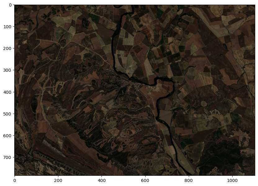
🔀 Methodology / Workflow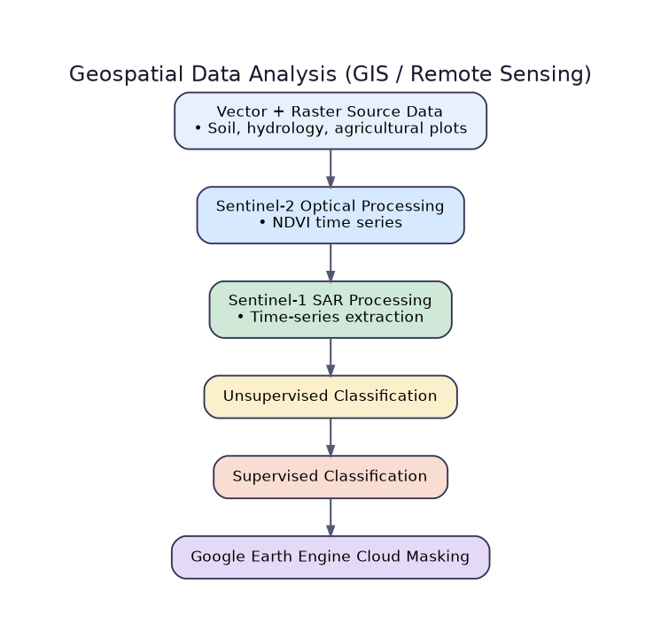
|
|
Turning sparse field samples into reliable, spatially continuous maps for real farm decisions.
|
Multitask Singularity Regression Kriging (MSRK) GeoAI framework combining a multiscale local singularity index, multitask Random Forest trend modelling, and residual kriging for precision-agriculture mapping of soil NPK, crop stress, and yield. 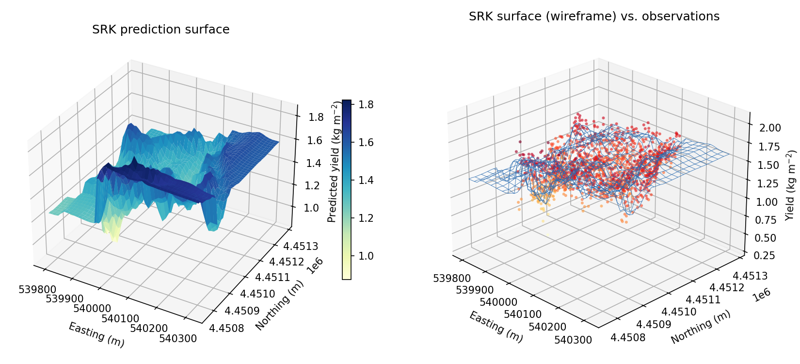
🔀 Methodology / Workflow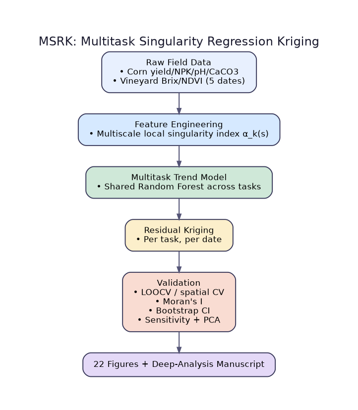
|
GIS-Based Livestock Slurry Suitability A multi-criteria GIS overlay combined with regression kriging and deep-learning suitability surfaces for livestock slurry application siting, case study in Tudela, Navarre, Spain. 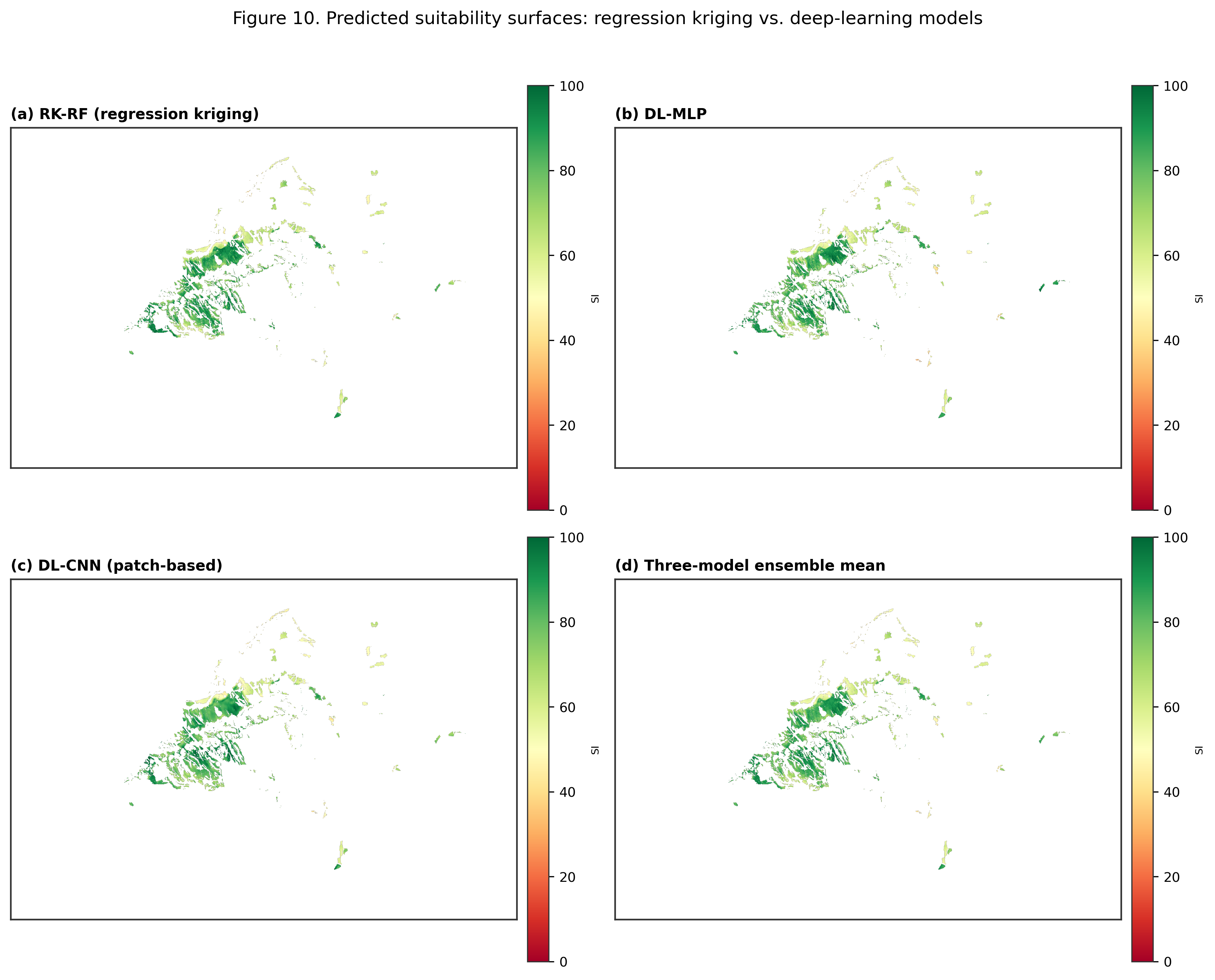
🔀 Methodology / Workflow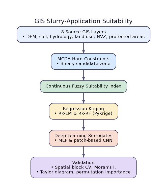
|
|
Operationalizing GIS & ML Across Cropping Systems Maize fertility zoning, vineyard pest monitoring, and grape ripening prediction across three linked Portuguese field practicals. 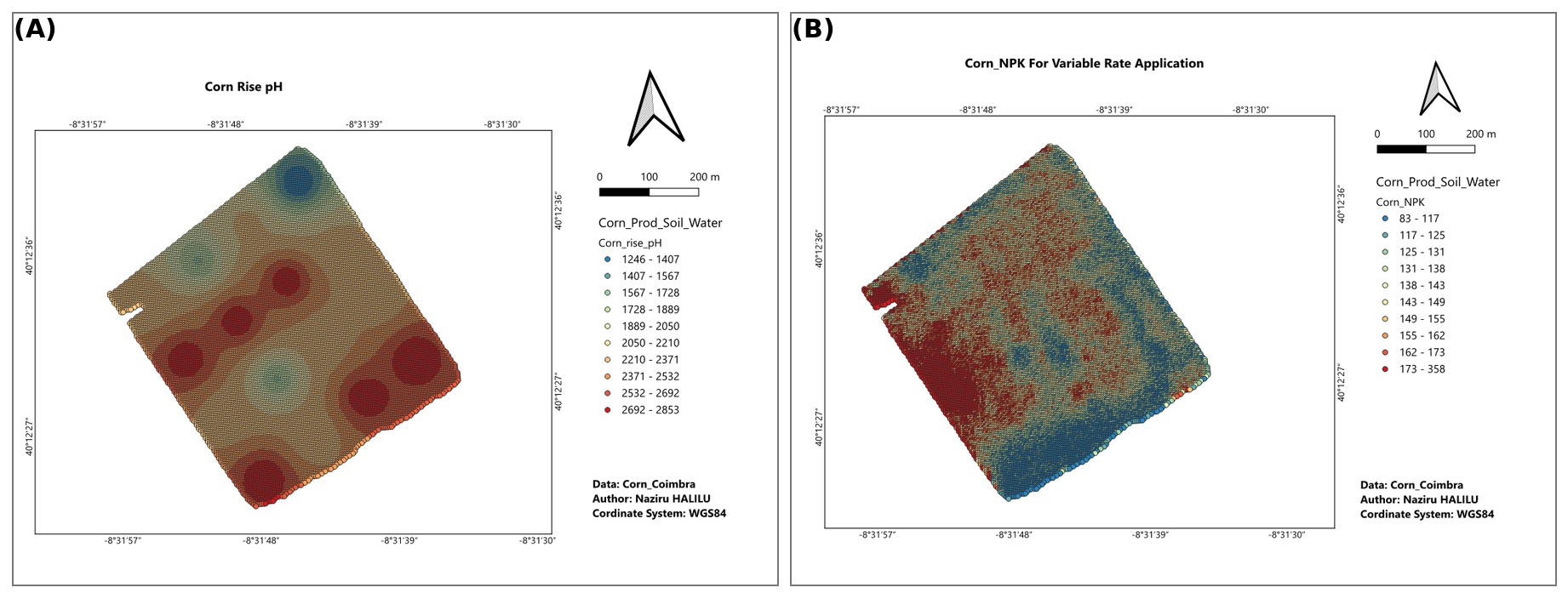
🔀 Methodology / Workflow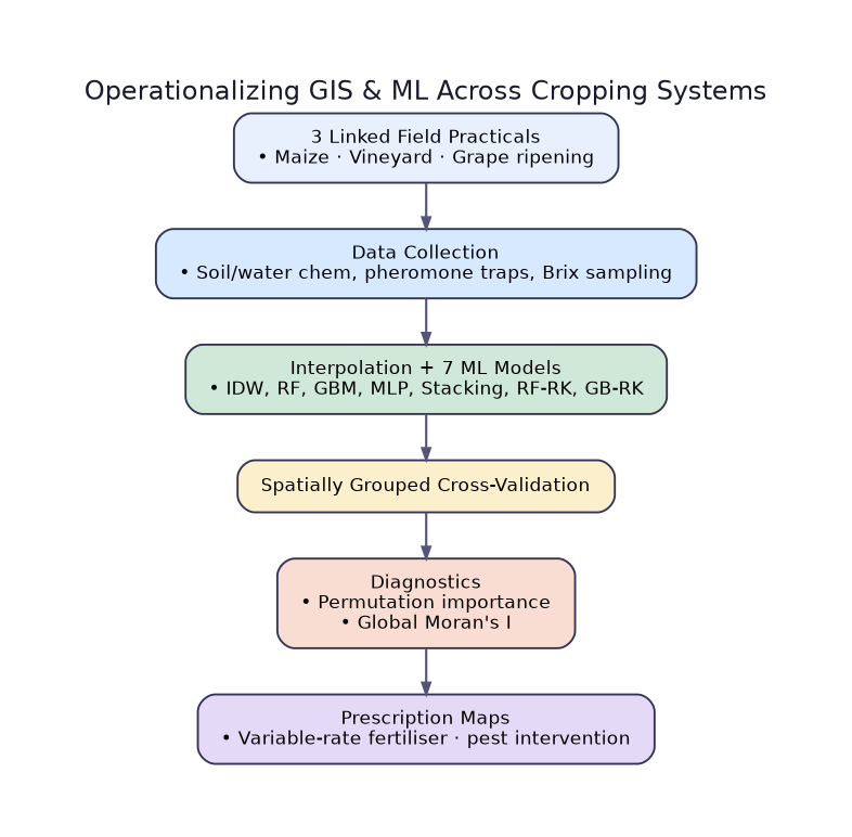
|
|
|
Terrain characterisation, mating-disruption costing, and delta-trap monitoring for Lobesia botrana at a 42.97-hectare vineyard estate in the Douro Demarcated Region, Portugal. 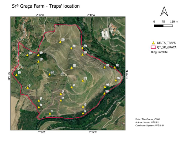
🔀 Methodology / Workflow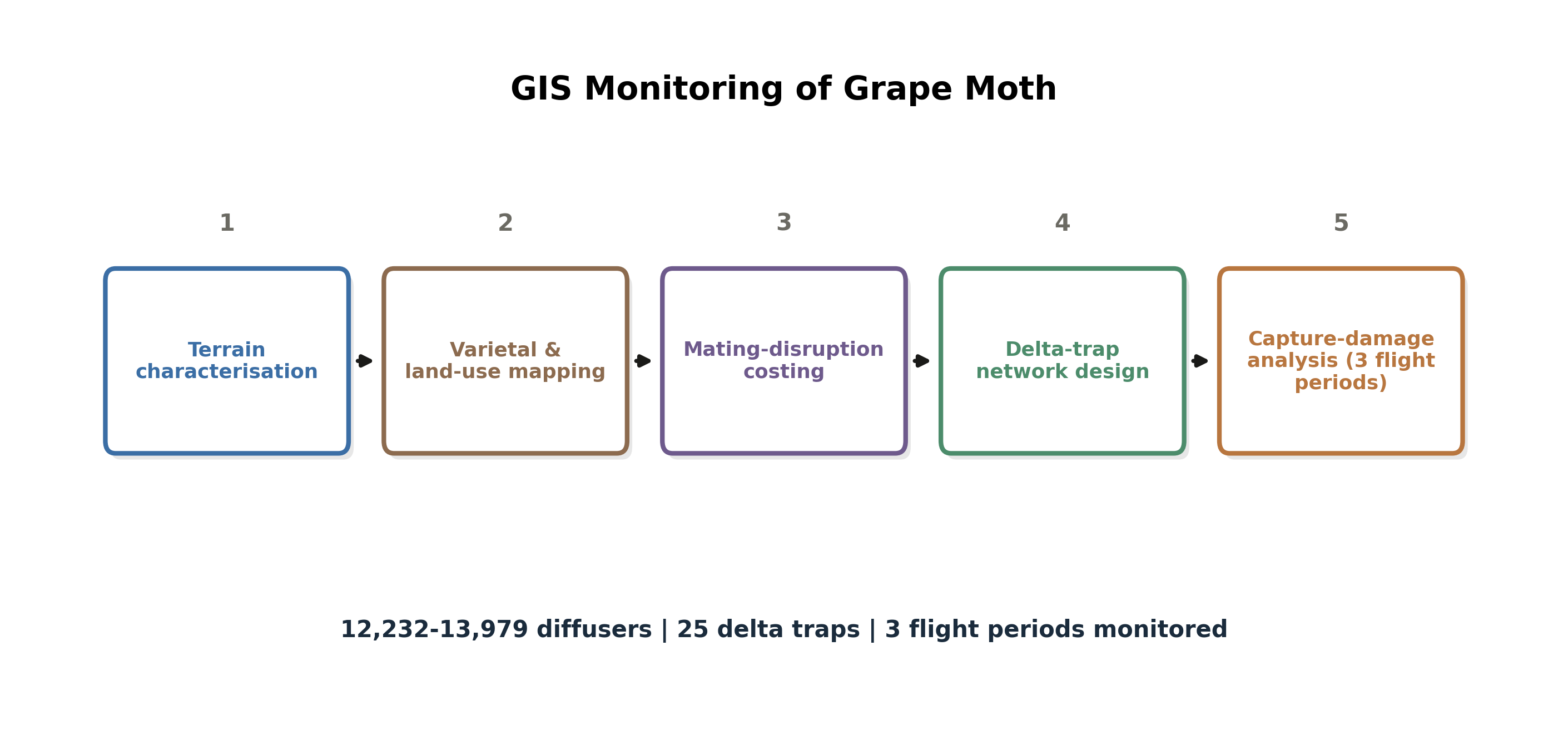
|
|
|
GIS Monitoring of Vineyard Ripening (Brix) NDVI and logarithmic regression harvest-date forecasting (R-squared = 0.9784) for grape ripening at a 6-hectare UTAD vineyard, Quinta de Nossa Senhora de Lurdes, Vila Real, Portugal. 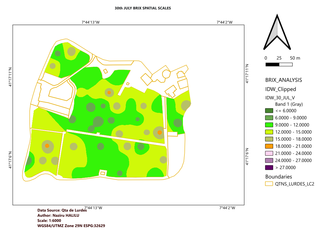
🔀 Methodology / Workflow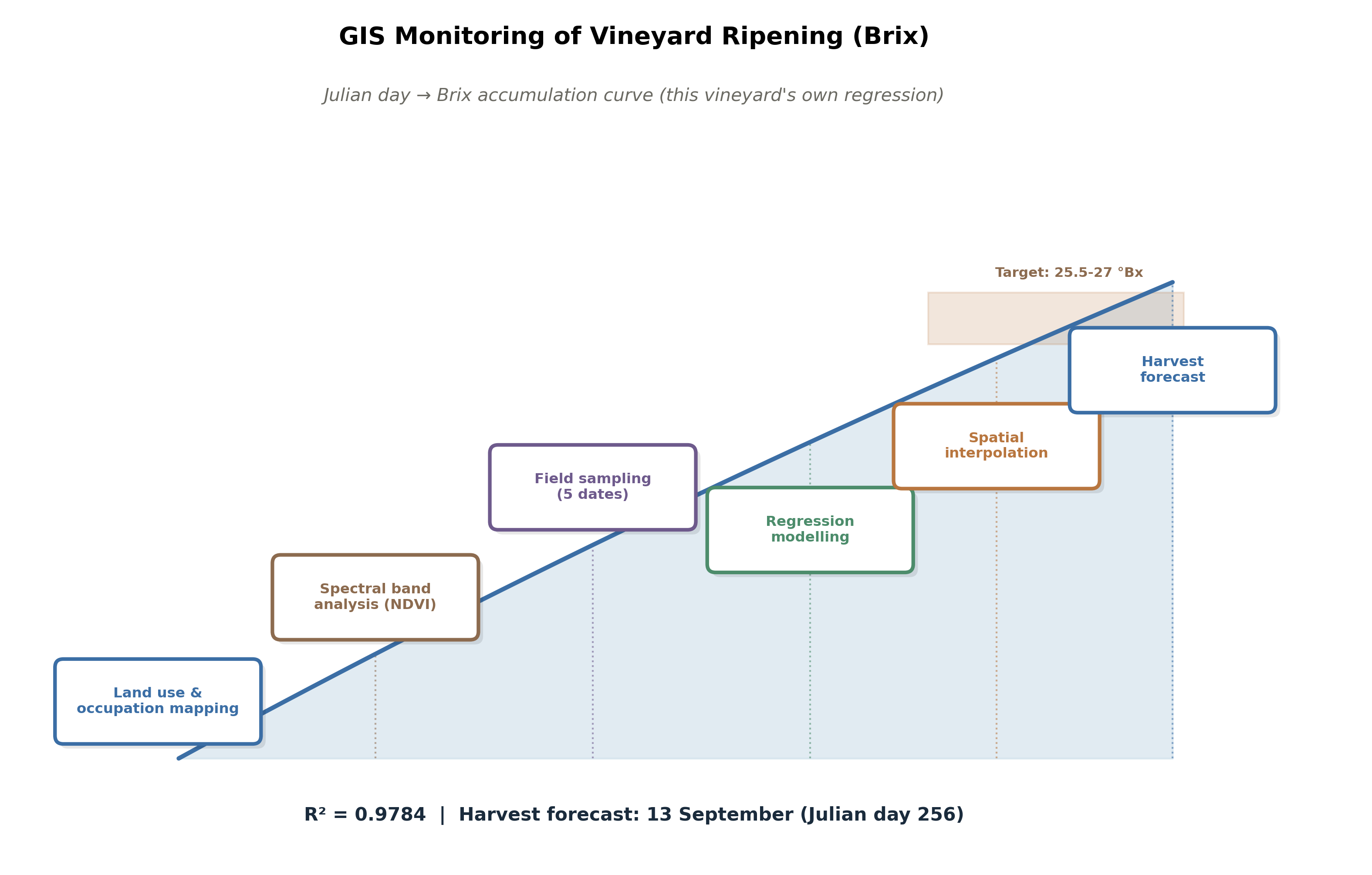
|
|
How much water a crop needs and when to apply it, an applied branch of hydrology focused on farm decision-making.
|
A modular Python pipeline with a Tkinter desktop GUI for reference/crop evapotranspiration, soil-water balance, irrigation scheduling, and a 4-step crop-growth simulation (canopy, transpiration, biomass, yield) for five crops grown around Zaria, Nigeria. Renamed and extended from the Zaria Crop ET and Irrigation DSS pipeline above. 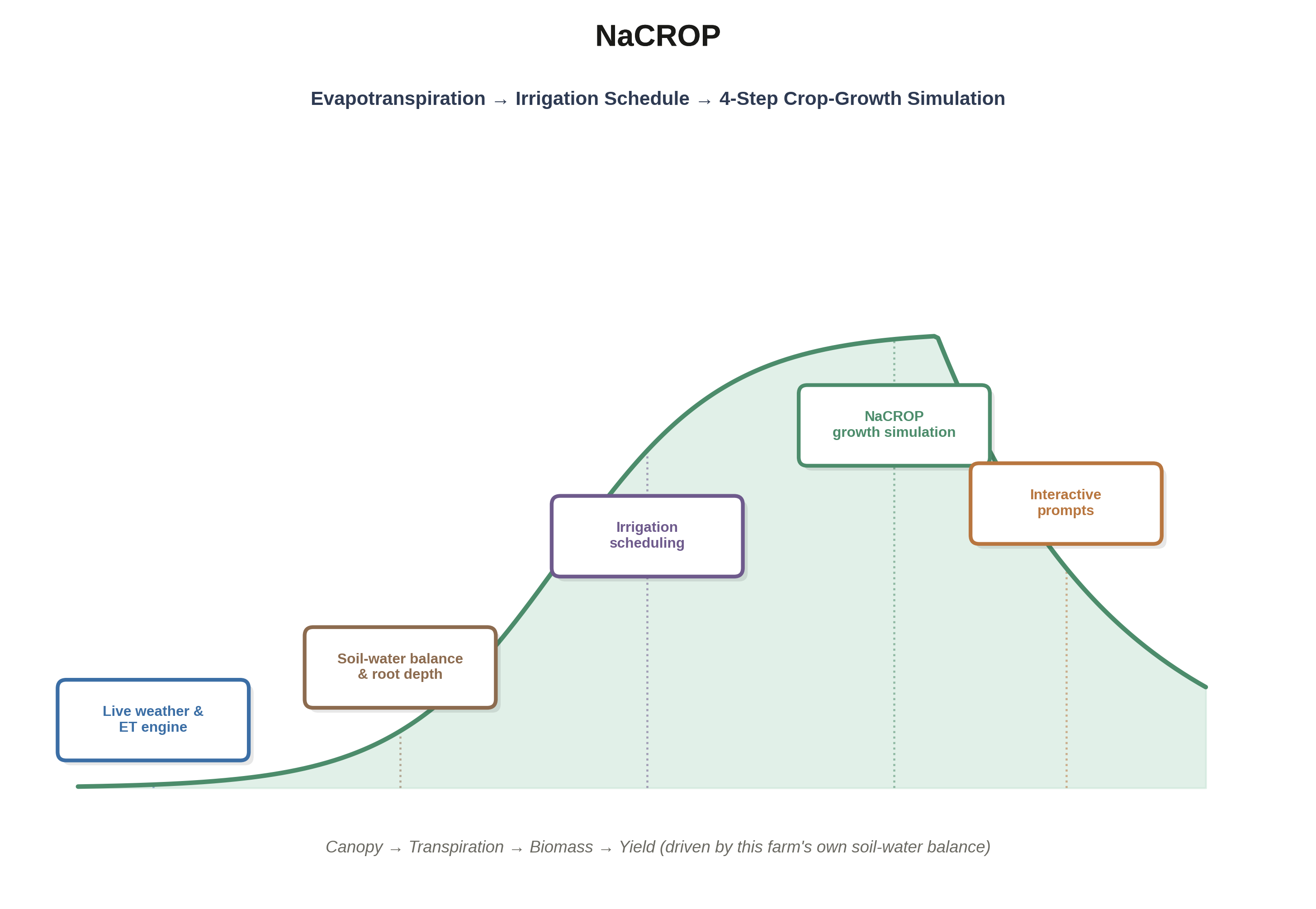
|
Zaria Crop ET and Irrigation DSS A modular Python pipeline with a Tkinter desktop GUI for reference/crop evapotranspiration, soil-water balance, irrigation scheduling, and full farm-report generation for five crops grown around Zaria, Nigeria. 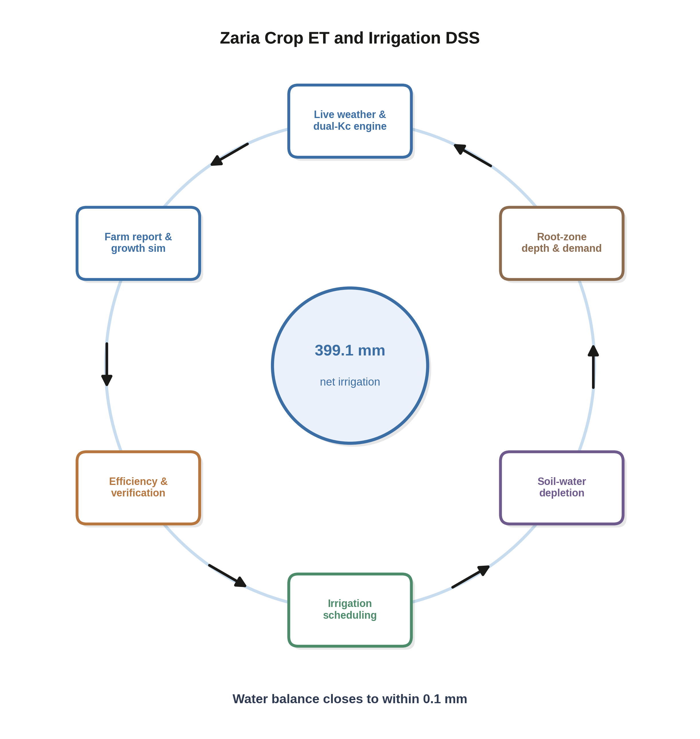
|
|
10,190 Daisy soil-plant-atmosphere simulations (10 soils, 17 experiments) mapping non-linear soil-atmosphere feedback loops between precision irrigation triggers, evaporation-control mulching, drainage, yield, and nitrate leaching. Three novel contributions: a soil-independent irrigation trigger law (root-zone depletion collapses suction-based triggers from 10 soils onto single curves), a closed water-balance account of where evaporation saved by mulching actually goes, and a regime map of when the dominant water-loss pathway switches from evaporation to drainage. 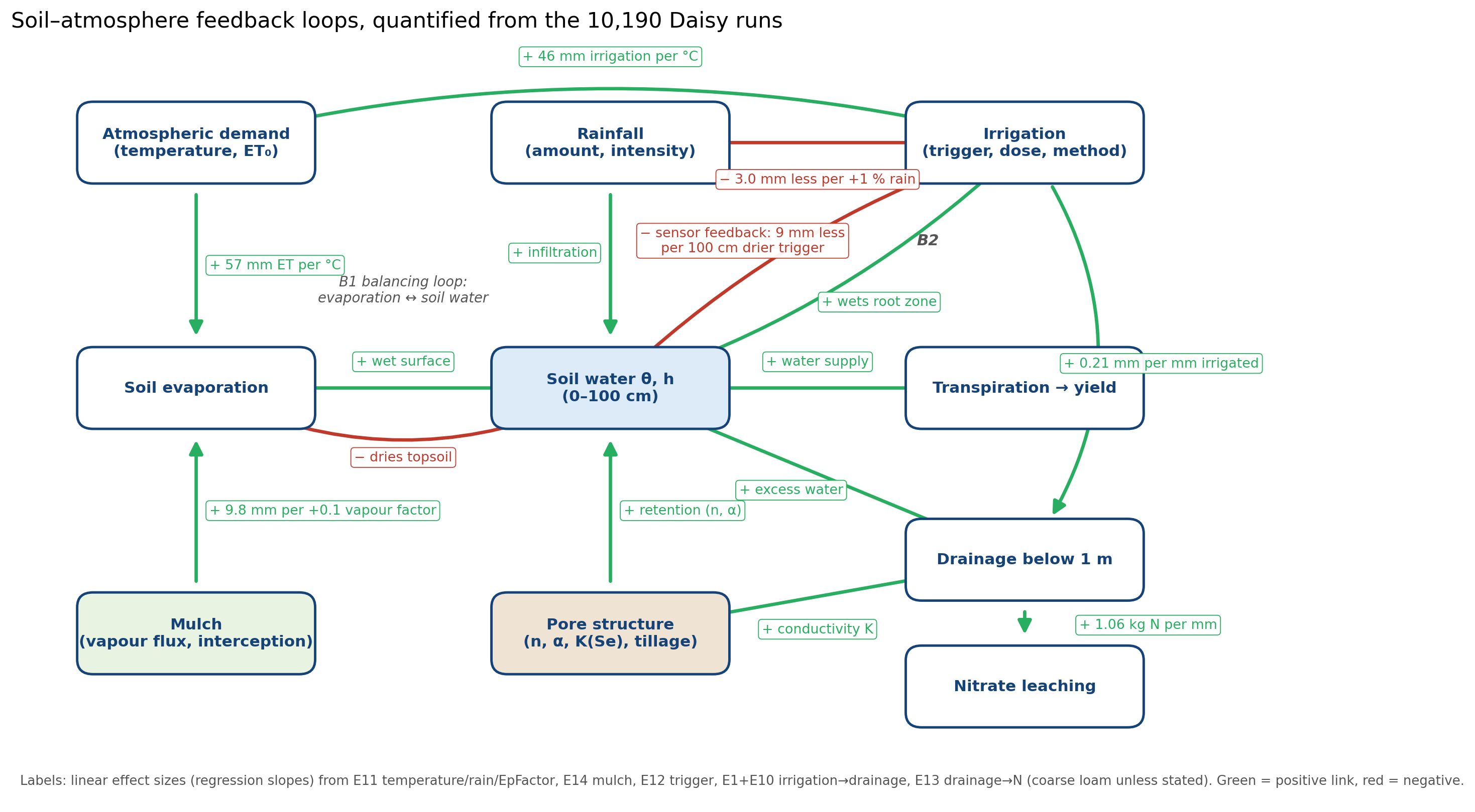
|
|
Business decisions and operations research rather than a physical or biological process.
|
Integrated Dairy Processing Decision-Support Model Compares several prediction models, then uses linear programming and repeated random-scenario simulation to recommend which dairy product to make each day under uncertain milk quality and market prices. 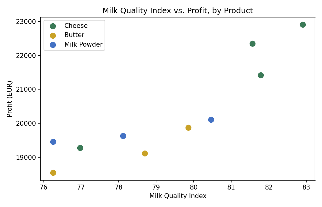
🔀 Methodology / Workflow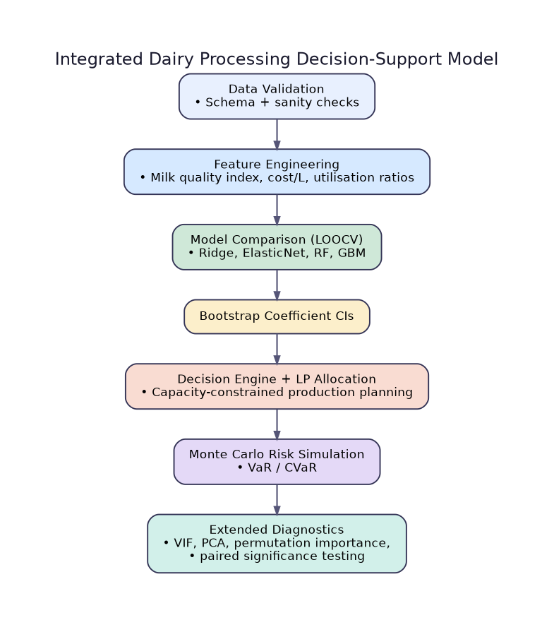
|
Python · GIS · Remote Sensing · Deep Learning · Computer Vision ·
Geostatistics · Google Earth Engine · Sentinel-1/2 · Precision Agriculture ·
Bayesian Methods · Decision Support Systems